Jentel Day 3: The Lay of the Land
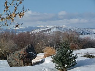
If the views don’t get you, the names will. Big Horn National Forest is just a stone’s throw from Jentel and the high peaks a little further (seen in the distance here). This photo was taken by a former Jentel resident in March:
With names like Cloud Peak, Dull Knife Resevoir, Crazy Woman Canyon, Lake Solitude and Bomber Mountain, I’m already rearing to go explore the area. This National Forest has glaciers and high peaks up to 13,000 feet in elevation and 1.1 million acres of land (189,000 of which are for foot or horse traffic only). I’ve studied the topographic maps and looked at the state highways in and around Sheridan County. Now, all I need is a pal with a car who wants to spend a day driving around the Forest, scoping out views, and reading interpretive signs.
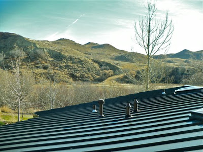
Meantime, I spent the afternoon working from the Jental Library in the loft of the Resident’s House. Here’s a mid-afternoon balcony view of the Snake Hills (a name for these particular foothills of the Big Horn Mountains, right along Lower Piney Creek):


