Lostine River Road
[Yesterday’s “new thing” was a 19-mile bike loop I hadn’t done yet. For today’s, read on…]
“You can’t get there from here” not only applies to the Zumwalt, but also currently to the deeper Forest Service roads of the high peaks due to our late spring. I explored Lostine River canyon this morning with low expectations, realizing my venture could turn into a driving tour rather than a hike, and that I’d likely be snowed out. Of course, I’d been here once before—at age 16—for that epic Eagle Cap 14-day trek that left me footsore but proud (not to mention totally hooked on the Wallowas). Of course, at that age I was huffing a 55-pound pack and glissading across high snowfields. My, how things change.
With the Hurricane Divide to the left and an equally steep rim to the right, the last 11 miles of Lostine River Road are all gravel, all Forest Service, and all dramatic. The road flirts with the 5,000-foot elevation mark and climbs slowly upriver. Mountains on either side ascend from the river bottom at a rate of about 1,000 feet per mile. (Translation: for every two paces you walk forward, you’re also gaining more than 1 foot in elevation.) I drove slowly, seatbelt undone, body crouched forward over the steering wheel to take in the angling views. With the windows down, I could easily hear the rushing Lostine River:
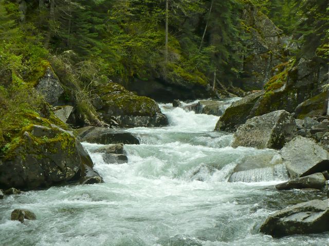
The threatened Chinook salmon, steelhead, and bull trout spawn in this river, traveling more than 500 miles and over several dams to do so. This isn’t spawning season, so I didn’t see any redds (nests) in the gravel bars or side streams, but I did see evidence of other wildlife: owl pellets, black bear tracks, elk scat, and a white tailed deer. Birdcalls and squirrel cries rivaled the river for attention, including two woodpeckers and a mother gray squirrel with her young clutched around her neck.
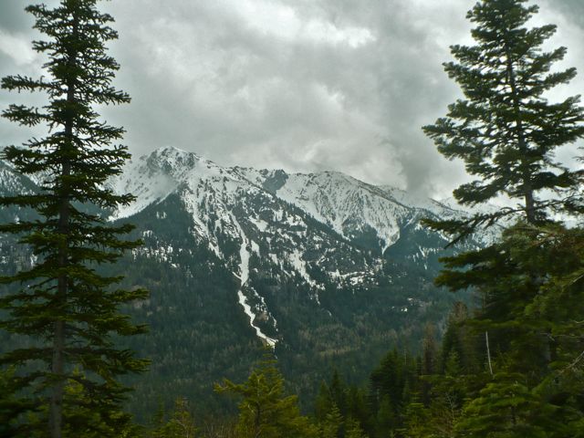
I didn’t get snowed out until Mile 7 at the Bowman/Frances Lake Trailhead. Four-wheel drive, ambition, and a healthy dose of stupid could get someone to the road’s end this time of year, but that’s not me. I parked and headed up trail in the direction of Chimney Lake. As soon as I hit the 6,000-foot elevation mark, the snow was so abundant on the trails that I lost interest. I did manage to enjoy lunch on a sunny, peaceful rock next to Bowman Creek. Here’s a view of Marble Point (9,100 feet, on the left) and part of the Hurricane Divide:
Turning back is always disappointing, but I prefer to focus on the more humbling aspects of this experience. For really just two months of the year, these trails open up enough to let the die-hards in. After that, you’re strapping on snow gear, planning overnights, and skiing or snowshoeing—all with the knowledge that a slide could make you turn around, a slide could take you out, or a storm could set your plans awry. It’s good, in a way, that Nature keeps us at bay. That even those who care immeasurably about the earth aren’t granted an all-access pass. That despite the barriers, much can still be enjoyed and, perhaps, even more. The imagination has no limits, after all, and as I sat there sunning on that rock, my mind traversed many more miles than my body or this late spring could ever permit.
Comments

Nice! Love the Lostine. Have you been to Devil's Gulch yet? MM 21 on Imnaha Highway? TNC land, nice hike!
ps. SUN? I saw none today over where I was.